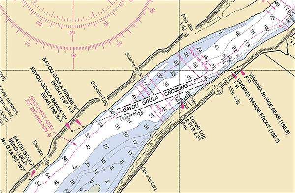
NOAA chart reveals underwater hazard for proposed anchorage area near Bayou Goula Crossing channel of Mississippi River.
Cartographers from NOAA’s Office of Coast Survey recently flagged a potentially dangerous situation during their review of a proposed federal rule establishing new anchorage areas on the Mississippi River.
The proposed anchorage areas were based on non-NOAA charts that did not depict the underwater pipelines. The pipelines, which carry benzene, posed a potential danger if ships dropped anchor on top of them.
The pipeline areas are depicted on the NOAA nautical chart. That chart data and original source files led to the cancellation of the proposed anchorage area.
The Office of Coast Survey is the nation's nautical chart maker, providing traditional paper charts as well as the charts used by commercial electronic navigational systems. The suite of nearly a thousand nautical charts covers 95,000 miles of U.S. coastline.