Electronic Charts on a Paper Scale
Posted by Eric Haun
November 17, 2015
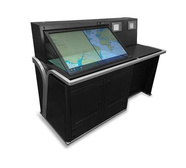
Image: Alphatron Marine
JRC and Alphatron Marine have launched a new digital AlphaChartTable comprising of a dramatically increased 46-inch touch display where routes can be planned on a “paper chart” scale.
By use of the digital chart table, navigators are now given an intuitive and user friendly interface to plan optimal routes by touch operation. The software gathers and overlays the data officers require, including ENCs, weather data, tidal information, digital publications, and other services like piracy updates – all on a single 46-inch display.
The console is designed as a natural fit to existing bridge designs. The display can be electronically tilted to a 35-degree angle for ergonomic purposes. In addition to the AlphaChartTable powered by NAVTOR, the console has a built-in Navtex and GPS navigator, while at the same time leaving room for the paper chart for back up purposes.