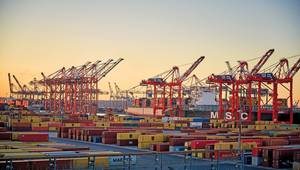
Waterborne cargo contributes more than $742b to the U.S. economy, and creates employment for more than 13 million people. To keep the marine transportation system functioning efficiently and safely, NOAA annually prioritizes areas that need hydrographic surveys. NOAA’s Office of Coast Survey has released the 2010 edition of the NOAA Hydrographic Survey Priorities.
NOAA prioritizes areas in need of surveying in order to maximize limited resources. In the 1990s, the agency examined the 3.4 million square nautical miles (SNM) of the U.S. Exclusive Economic Zone (EEZ) for navigational significance, and determined that approximately 500,000 SNM of the EEZ are navigationally significant. Of those significant areas, NOAA identified approximately 43,000 SNM as critical areas. These areas are primarily coastal shipping lanes and approaches to major U.S. ports.
The Survey Priorities document depicts the current hydrographic needs of the nation. The 2010 edition reflects the 2,331 SNM of critical area surveyed since the 2009 edition. Of the 43,000 SNM of critical area, this edition displays the 16,870 SNM that remains to be surveyed.
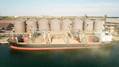
NOAA re-examines and prioritizes the nation’s survey requirements to address the dynamic trends in waterborne commerce, the increasing size and draft of commercial vessels, seafloor changes, and the ability to produce more detailed hydrographic surveys with modern technologies. The highest priority areas, “critical areas,” are defined as waterways with high commercial traffic volumes (cargo, fishing vessels, cruise ships, ferries, etc.); extensive petroleum, liquefied natural gas or hazardous material transport, compelling requests from users; and/or transiting vessels with low under‐keel clearance over the seafloor.
NOAA Office of Coast Survey is the nation’s chartmaker, surveying U.S. coastlines and producing charts since 1807.
The 2010 edition of the NOAA Hydrographic Survey Priorities is available on the Web: http://www.nauticalcharts.noaa.gov/hsd/NHSP.htm