Aerospace solutions provider Airbus Defense and Space has upgraded its digital maritime service to detect and track vessels around the globe.
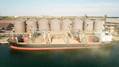
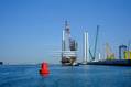
First launched in 2018, OceanFinder leverages Airbus’ advanced constellation of optical and radar satellites, combined with real-time global Automatic Identification System (AIS) data, and the latest in automated analytics, to support a broad range of critical applications across defense and security, shipping, oil and gas, and insurance markets.
OceanFinder’s latest updates introduce a number of innovative features – extending the service’s capabilities in several key areas.
From today, users will benefit from enhanced imagery and AIS data correlation to identify the precise location of a non-responding vessel in near real-time. This development has been combined with the latest in fully-automated detection and classification, which utilities powerful proprietary algorithms to determine a vessel’s identity in just a few seconds.
Subsequently, Airbus’ human analysts are able to focus on providing additional, value-added intelligence, such as interpretation of specific behavior or threats, without delaying a report’s delivery. New tools have also been incorporated to provide the most relevant acquisition plan to predict routes and projected locations of vessels, based on last position, date, trajectory and speed.
Several of the unique features have been made possible through a multi-year partnership with exactEarth, a leading provider of satellite-AIS data services. The agreement, which provides OceanFinder with access to exactView RT – exactEarth’s second-generation real-time satellite-AIS data platform – includes all live and archived data.
“By combining Airbus’ satellite imagery with the most advanced AIS data services and analytics, we are positioning OceanFinder as a key reference for maritime detection and identification” said François Lombard, Director of the Intelligence Business for Airbus Defence and Space.
“Automation and near real-time are the two pillars through which we will provide our customers with the insights they need to make decisions faster, whether for real-time situational awareness, Search and Rescue operations or location and tracking of illegal maritime activities,” François added.