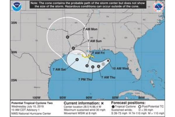
Invest 92-L, which may become Tropical Storm Barry by Thursday, is becoming better organized this morning as satellite imagery and surface weather observations indicate that a circulation seems to be developing over the northeastern Gulf of Mexico.
In addition, it appears that the deeper thunderstorm activity is occurring offshore and it appears that Invest 92-L is located further south than what many of the model guidance members have indicated in their forecasts. This means that the Texas and Louisiana coastline is at significant risk from a hurricane landfall on Saturday.
ACBL’s Hurricane Task Force is monitoring the tropical disturbance and will notify customers of additional information and action plans as the storm progresses.
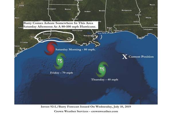
Per below forecast from Crown Weather Services, the storm is likely to make landfall between Houston-Galveston, Texas and Vermillion Bay/New Iberia, Louisiana as a hurricane with 80 to 100 mph winds.
Source: ACBL